Information
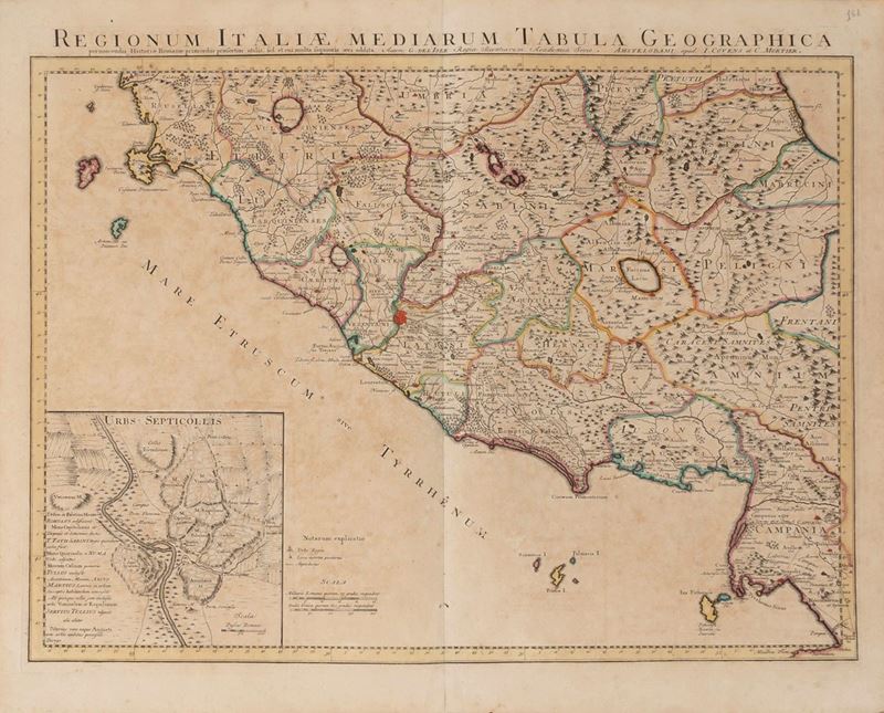
Amsterdam, Apud Covens et Mortier, 1745. Vintage watercolor colored copperplate engraving. Measurement cm. 60.5 x 46.5 plus margin. Reinforcement at the central fold.
Specialist Notes
Beautiful historical map of central Italy, centered on Rome, including Tuscany, Campania up to Pompeii, the island of Giglio and the city of Orbetello. At the bottom left an insert with a plan of ancient Rome. Guillaume de l'Isle, appointed Royal Geographer in 1718, was the leading French cartographer of the early 18th century and certainly one of the most influential.
Contact
Condition report
To request a Condition Report, please contact libriestampe@finarte.it
The department will provide you with a general report of the condition of the property described above. Please note that what Finarte declares with respect to the state of conservation of the objects corresponds only to a qualified opinion and that we are not professional conservators or restorers.
We urge you to consult with a restorer or conservator of your choice who will be better able to provide a detailed, professional report. We always suggest prospective buyers to inspect each lot to satisfy themselves as to condition during the exhibition days as indicated in the catalog.
Suggested lots
Caricamento lotti suggeriti...