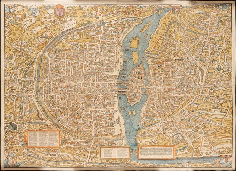
Zurich, Editions Seefeld, 1980. Two sheets reproducing the original size of 136 x 100 cm, impression in 9 colors on two sheets of 70 x 100 cm respectively, matching, drawn on special paper of 180 gr. Attached is a scientific study by Jean Dérens, with an introduction by Jacques Chirac (mayor of Paris at the time) and a preface by Michel Fleury. 90 pages in 270 x 340 mm format. with 132 black illustrations and a color planche, hardcover binding. Edition of 900 copies of which only 500 copies are on the market
Specialist Notes
Facsimile edition of the rare map of Paris by Truschet and Hoyau, called "Plan de Bale" (AA 124), preserved in the Public Library of the University of Basel. Montorgueil in Paris, the designer Olivier Truschet and the engraver Germain Hoyau, who had joined forces to produce large-format images for hanging. A largely unpublished representation of Paris, with architectural and urban elements currently no longer present, and therefore UNIQUE testimony of Renaissance Paris.
This website uses cookies so that we can provide you with the best user experience possible. Cookie information is stored in your browser and performs functions such as recognising you when you return to our website and helping our team to understand which sections of the website you find most interesting and useful.
Strictly Necessary Cookies
Strictly Necessary Cookie should be enabled at all times so that we can save your preferences for cookie settings.
If you disable this cookie, we will not be able to save your preferences. This means that every time you visit this website you will need to enable or disable cookies again.
3rd Party Cookies
This website uses Google Analytics to collect anonymous information such as the number of visitors to the site, and the most popular pages.
Keeping this cookie enabled helps us to improve our website.
Please enable Strictly Necessary Cookies first so that we can save your preferences!