394
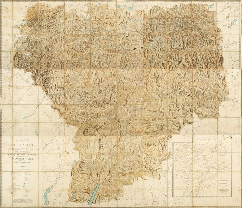
Cartografia - Tirolo
Cartografia - Tirolo
Carte du Tyrol Vérifiée et corrigée sur le mémoires de Dupuis et de La Luzerne and réduite d’après cella d’Anich et Hueber, 1808
Estimate
€ 400 - 600
Sold
€ 704
The price includes buyer's premium
Do you have a similar item you would like to sell?
Information
s.e, s.l, [Milan, Gioachimo Bettalli] 1808. Large paper in excellent condition in 6 parts of which 3 of 57 x 84 cm made up of 16 sheets each, and 3 of 57 x 114 cm made up of 24 sheets each, sheets mounted on beige canvas, slight blooms, inside marbled paper case, with paper insert with title.
Specialist Notes
Beautiful geographical map describing the territory of Tyrol and made by the best cartographers of the Depot General de la Guerre. The phases that led to the realization of the map start from the so-called "Atlas Tyrolensis", created by Ignaz Weinhart, Peter Anich and Blasius Huber in 1774. This work was subsequently updated thanks to the colonel of the Dragons Dupuis and in 1777 by the knight de La Luzerne.
Contact
Suggested lots
Caricamento lotti suggeriti...
More Lots
396
Francesco Costantino Marmocchi
Atlas of Universal Geography, 1838
Estimate € 450 - 600
Starting bid € 450
398